 INDIVIDUAL SPORT COACHING CLINIC
Orienteering: a practical guide
September 19, 2018 by Stefano Raus
Instructor: Stefano RausTutor: Tomi Paalanen
Sport: Foot Orienteering
Subject: Orienteering: a practical guide
Date & Time: Wed. 19.9.2018 14:15-15:45
Target Group: From beginners to experienced
Clothing: Sport clothes and running shoes
Equipment: Presentation, orienteering gear, maps, orienteering flags with punches, compass, GPS watch, mobile phone, tablet
RESOURCES:
Download the Lesson Plan in PDF
Download the Startlist in PDF
LESSON OBJECTIVES:
A. Physical Students walk/run reading the map on different kinds of terrain by themselves and in group
B. Cognitive Students discover/understand the potential of orienteering and learn what are the requirements
C. Emotional & Social Students work together to finish the final course and see maybe new places around Vierumaki
MY GOALS:
A. Physical Give the students the sense of what running foot orienteering is and physical requirements
B. Cognitive Teach the students how orienteering can be used with exercises and new technologies
C. Emotional & Social Run each step without skipping any information and get everybody actively involved in the clinic (individually and in group)
1. PRESENTATION
Time: 20 min
Goals: Some students might have been present at last year’s clinic, but others might be completely new with orienteering, so I will start from zero but quickly. It’s important to know how to read a map (symbols and colors) and how to understand a map with a course on it.
Learning content: Aerial image and proper map Legend with symbols Symbols of an o course Clothes and shoes Other gear (compass, card) O-competitions: sprint, middle, long, ultralong, relay, night-o, mtb-o, ski-o, trail-o
Details/feedback: - recurrence of usage of visual memory to get quickly familiar with the orienteering map - tell them clearly and easily what kind of map we are going to use not getting in too deep in the argument (scale and legend also on the map) - symbols and courses are easy and there is no need of a legend on the map - orienteering is pure fun and everybody will be excited to get out of the classroom and do it
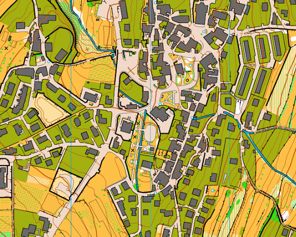
Teaching style: With the projector, we have a look at the aerial image of Vierumaki and its orienteering map. Learn scale, symbols, colors of orienteering maps and how to read an orienteering course. We check what gear is important for trainings/competitions and which kind of competitions we do.
2. VIDEO
Time: 5 min
Goals: See how an orienteer runs (focus of feet, head, hands, body posture, map reading) and different terrain situations (wet, rocky, slippery, steep and control punching)
Learning content: - ankles must be well warmed-up - head has to see other obstacles and where to put the feet + able to read the map at the same time - hands with a firm grip to the map, holding compass, watch and punching card (use of hands to climb)
Details/feedback: I will ask if they have questions at the end and explain the rest of the clinic before going out (drills, goals, locations, etc…) If they want I have 2 more videos: Orienteering – Training in Norway Orienteering – More than just running (Austria Junior National Team)
Teaching style: 2 mins 46 secs videoclip from a German orienteering club. 3 orienteers run in a beautiful forest at different paces I will have a short introduction before the video to tell them what to focus on; then I’ll talk during the video and stop it when needed.
3. MAPPING EXERCISE
Time: 15 min
Goals: After showing them some games and activities that any coach or teacher could do in a sport camp or practice, we will do some mapping. Also it’s very simple and easy to organize in the class.
Learning content: - take a sheet and a pen - organize and move a bit the objects in the class (tables, chairs, bins, etc…) - students have to draw a map of the delimited area - comments about the result at the end
Details/feedback: Students should do the following things: mark all useful objects (doors and windows included), mark where North is, write some kind of scale, define a legend, use different colors. Write their name on the map and give back when completed.
Teaching style: Students will receive the piece of paper and are free to move all around the classroom. There is time limit of 5 or 10 minutes depending how good they are working.
4. COURSE
Time: 30 min
Goals: I want to show them how an actual course of a race works. They will experience it themselves and they are timed. They will have fun and master what they have learnt/practiced before.
Learning content: Concentration before the start Starting procedures Time keeping procedures ‘Old school’ punching system Live GPS system (Android mobile with internet data and GPS location – me at the finish with tablet) All drills practiced before ‘Race’ feelings Real flags and punches
Details/feedback: - do not loose in your position on the map, use your finger to remember that - do not follow anybody - do your own route choices and decisions - always read the map and try to find the best (quickest/shortest route) - have fun! - don’t be afraid about getting lost, be happy about getting back on the right way
Teaching style: Orienteering with sprint (1:5000 - ISSOM) map of Vierumaki Campus. Start/finish east of Bubble with 2 minutes interval (student doesn’t have to see where went the one started before him/her) or less if many students are attending 9 control points: regular orienteering flags (30x30cm) with punches. Students must punch each control in the right box on the map.
5. POST ACTIVITY ANALYSIS
Time: 10 min
Goals: Students have to complete the clinic positively and learning from what they did during the course. They have to discuss between each other about things they have just learnt.
Learning content: Draw route on the map Decide which were the best route choices Discussion with other runners Understanding of strengths and weakness
Details/feedback: - comments depending on how good the students were and comparing what I would have done - general overview and positive feedback
Teaching style: We use the maps of the final exercise and the total times. We also use GPS replay if I can set it up outside (no internet connection).
OPTIONAL: Walk
Time: 10 min
Goals: If we are on time we can use this exercise to get students to know better how to move with a map and reach the race starting point. Maybe reach some controls and test.
Learning content: Move with map Orientate the map to North Use also visible objects to keep map orientated Find some small flags and check the control codes
Details/feedback: - no need of compass - check the map scale - find the flags from distance - imagine or remember known areas - get used to read a map while walking/running
Teaching style: Students will receive a map in scale 1:2000, with some controls and codes on them. There are small (10x10cm) flags just around Bubble and Kaskela buildings.
COURSE RESULTS:
1. Torsti 12.33
2. Rafu 12.49
3. Jenni 17.20
4. Andrea 18.17
5. Mette 19.29
6. Piers & Jonna 20.17
7. Arina 22.01
8. Arnaud 23.22
9. Kiia & Natal 24.14
10. Mitja 26.20
11. Kaede 33.02

AND PLEASE, TAKE A LOOK AT THE POWERPOINT PRESENTATION BELOW:


